


Exploring the coast of British Columbia by motorcycle
From visiting towns on the Sunshine Coast to ferry crossings between islands in the Salish Sea, riding two-up on a small-cylinder bike turned out better than I thought

A travelogue
My wife is an Aries. I’m a Virgo.
As astrologists will tell you, Aries is a fire sign, Virgo is an earth sign. According to the zodiac, Aries people are enthusiastic, spontaneous and bold. Virgo people have a tendency to be grounded, plodding and fussy. In my experience, this seems about right.
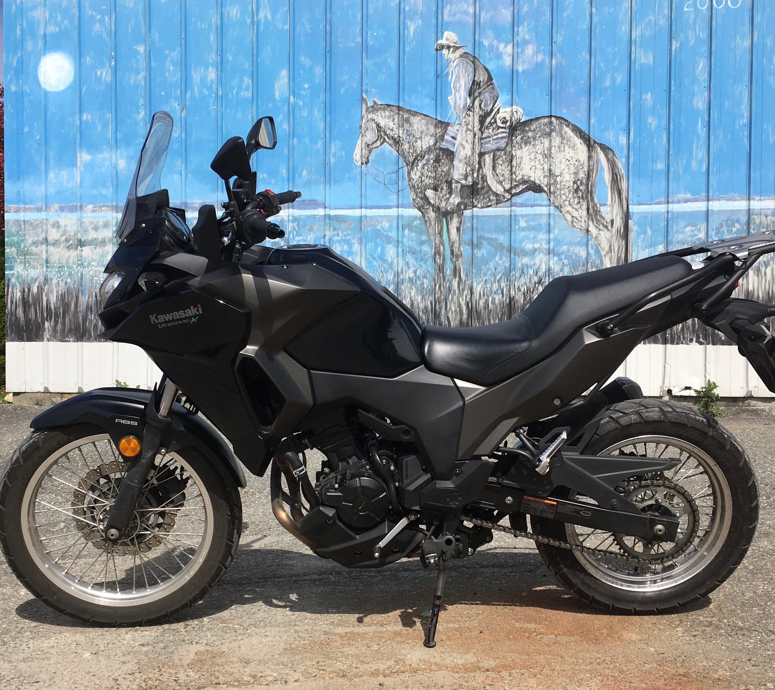
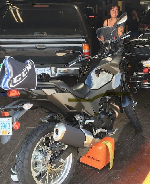
Knowing how much I like riding my motorbike, my spouse, Patti, recently suggested we visit our friends on British Columbia’s Sunshine Coast by motorcycle. Soon after, I started to wonder whether we could combine the visit with a longer motorcycle ride. Where Patti quickly sees opportunities, I sometimes get stuck on the details. I began to think the idea was a bit ambitious. I started to ask questions like this: could my smallish Kawasaki (300cc engine) handle a long trip in this area with the weight of two people and bags? What would we do if it rained the whole time? What was our backup plan if something went wrong?
I shouldn’t have worried so much. It turned out fine.
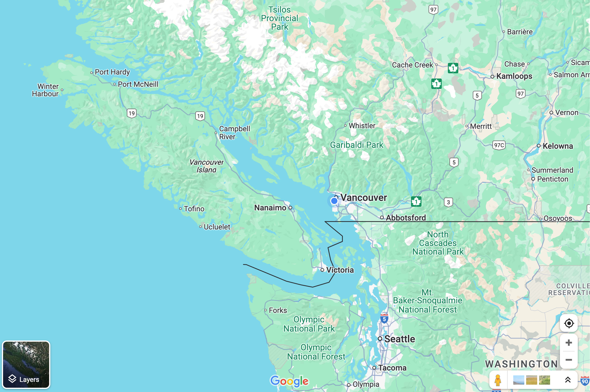
The idea quickly developed into making the trip a true coastal circle, following Highway 101 up the western coast of the mainland and then taking a ferry over to Vancouver Island and travelling south before returning again by ferry to the mainland.
Other reasons that supported this plan were: a) motorcycles are charged lower fees than cars on the intercoastal ships; and b) reservations would not be required, as ferries accommodate bikes at the front or the back of the ships in the space around larger vehicles. This started to sound appealing.
Steep mountainous terrain and many ocean inlets on the Sunshine Coast mean there are no road connections with the rest of British Columbia. So unless one has a private yacht or plane, the only way to get there is by ferry.
As it turned out, our ride brought us in close contact with some of the most beautiful natural settings on the coast, a great day with good friends, appreciation of indigenous culture, encounters with colourful people and moments of true wonder.
The route

West Vancouver to Gibsons
As we set off on a Saturday afternoon, it was windy and cool, about 16 degrees Celsius (60 Fahrenheit). We rode to the ferry terminal in Horseshoe Bay, which is in West Vancouver, across the Lions Gate Bridge. From there we boarded a ferry bound for Langdale, about 35 kilometres (22 miles) in a northwesterly direction. Langdale is on the outskirts of the town of Gibsons, the first significant population hub you encounter on the Sunshine Coast.
Originally developed as a forestry and commercial fishing centre, Gibsons has, over time, increasingly become a place where many people enjoy living their retirement years. Some people commute to the mainland for work. It has a vibrant arts scene and is known for its relaxed mood (like the rest of the region, for that matter).
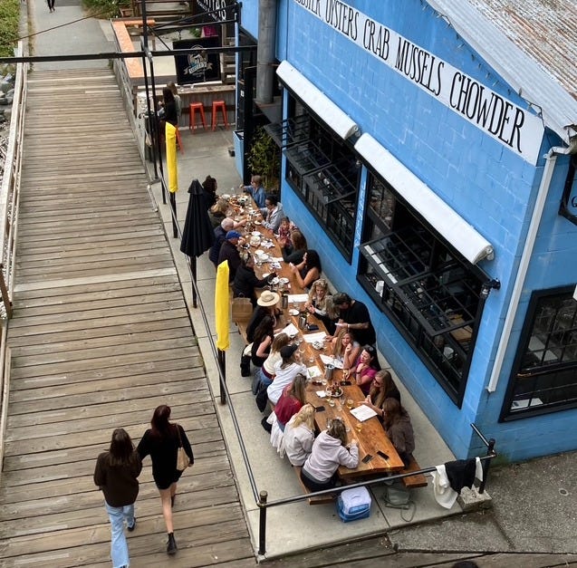
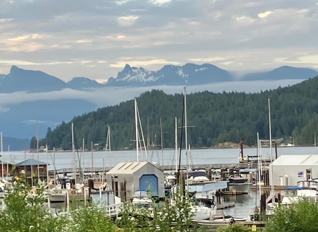
Patti had called ahead for accommodations and we arrived at the convenient and clean Gibsons Landing Inn without any problems. We walked around town and spent some time at the waterfront where we ate dinner as we watched people and boats in the marina.
A day in Gibsons
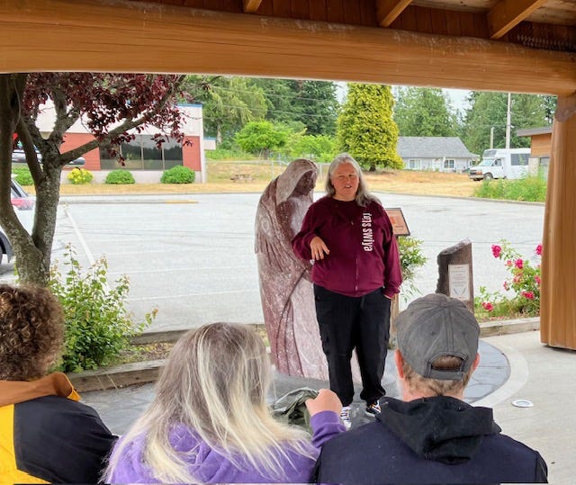
The next day was spent with our friends. They graciously arranged for us to participate in a walking tour in the nearby town of Sechelt, led by local artist and indigenous storyteller Candace Campo, who has developed a reputation for being an excellent guide.
The focus of the tour, “Talking Totems,” was an exploration of indigenous ways. With Candace we walked in the footsteps of the local shíshálh people. (They don’t capitalize the initial “s”.) Through personal recollections and stories, she explained the intricate relationships that connected the shíshálh Nation to both land and sea, and to other indigenous people and tribes in the Salish Sea region.
No discussion of our shared history can escape the sad chapter of the residential school system, when white colonizers forced indigenous people into religious institutions in an attempt to indoctrinate them by suppressing their traditions and languages.
One of the paths to reconciliation is through listening and understanding. I felt extremely grateful and humbled that Candace was so willing to tell us her people’s journey with such openness and candor.
She pointed out that reconciliation protocols also applied to aboriginal groups who had disputes or fought one another in the past.
The walk took us to an area near where St. Augustine’s Residential School operated from 1904 to 1975. Candace showed us some totems that communicated this sad history.
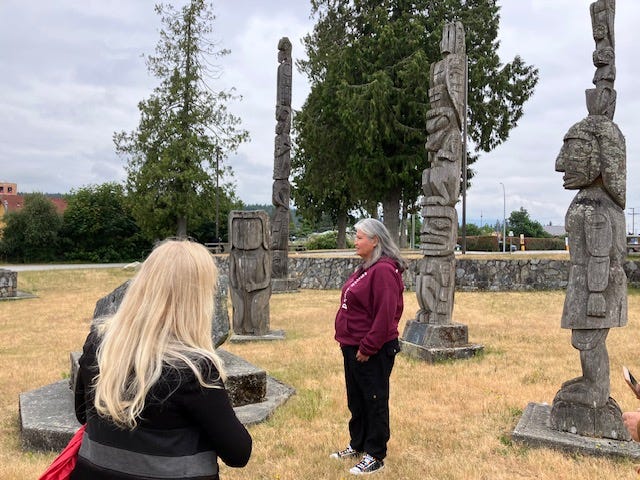
One totem was particularly impactful. It had no face, symbolizing the stealing of the people’s identity by the residential school.
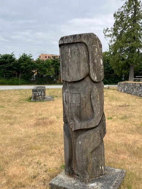
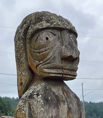
Candace explained that at the end of a totem’s life, as the wood cracks and wears away, native people celebrate the pole’s contributions to the community. Old totems are removed from their supports and returned to their natural environment, where they are respectfully laid down to decay gracefully and be reabsorbed into the earth.
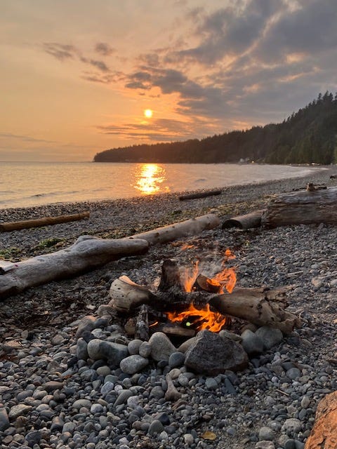
In the afternoon, our friends, Susanne and Marina, suggested we have dinner on the beach with an open fire to cook our meal. We bought some sausages, buns, snacks and cherries at a local supermarket. Susanne drove us down to Bonniebrook Beach, where we got the campfire going and had a great meal together. It’s hard to express how much we appreciated their hospitality.
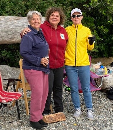
The sun rewarded us with a beautiful sunset, which was the perfect end to a pleasant day.
Up the Sunshine Coast to Earl’s Cove
The next morning, Patti and I left Gibsons early at 6:30, eager to make our way along the coast to Earl’s Cove, where we intended to catch the 8:20 ferry to Saltery Bay, near Powell River.
The drive passes through Robert’s Creek, Sechelt, Halfmoon Bay, and Madeira Park. The road winds for about about 75 kilometres (47 miles) through undulating ground on the side of mountains covered in old growth pine forests, with frequent views of the sea.
For a motorcycle rider, twisty serpentine roads are a dream. Leaning into corners and frequently changing gears makes the riding fun, and I must confess I should have gone a little slower in sections, since at that time of the morning wildlife is often active. Sure enough, after rounding a bend we saw a large deer bounding across the road ahead of a car in front of us. It was a good reminder to consider the risks and slow down. I would have enjoyed the ride much more if I wasn’t also thinking as much about arriving in time for the ferry.
We made it with lots of time to spare.
Earl’s Cove to Saltery Bay and Powell River
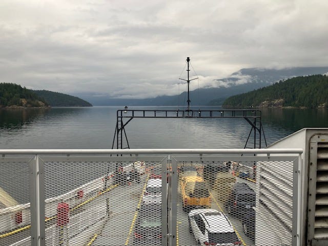
The trip to Saltery Bay, a 50-minute crossing, was, to our delight, free-of-charge. It had been another chilly morning with low clouds, but no rain in the forecast.
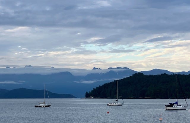
This area of the Pacific Northwest reminds me a lot of Alaska. As the ferry navigated around the many islands in the Strait of Georgia and crossed open stretches of ocean, the mountains appeared as reclining giants. For eons the sea has flooded this area; or more accurately, the mountains have been thrust up and out of the sea by tectonic forces, as two different continental plates gradually collided. Looking around from aboard the ferry I had the clear awareness that we were travelling between many submerged peaks. In fact, extending north from Earl’s Cove, Jervis Inlet is the deepest fjord in British Columbia. It has a depth of 670 metres (over 2,000 feet). A ferry quartermaster on the pier told me that the U.S. Navy comes to this area to test their small submersible vessels.
After the short ride from the ferry dock in Saltery Bay, we arrived in Powell River where we ate breakfast at a fast food restaurant, then lined up for another ferry ride, this time to cross the Strait of Georgia to Comox on Vancouver Island. If we were to make it home by evening we needed to make these ferry connections. As we waited in line with other vehicles, the day warmed up nicely.
Powell River to Comox
The sea route passes between Texada Island, the largest of the northern Gulf islands, on the left, and Ahgykson Island on the right. Ahgykson is part of the traditional territory of the Sliammon First Nation.
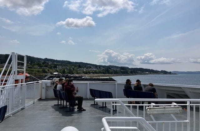
The crossing to Comox takes about 90-minutes. I enjoyed the view from the upper deck for a while and then went inside. A truck driver with a forestry company who was heading home for a few days of rest was in the mood to chat. He told me that in his entire 27-year career he has been driving the same vehicle, a truck built in the 1970s, but still entirely reliable. He raved about its resilience. ”I know it better than I know my wife,” he said. His description of traversing steep mountainsides on dirt roads (often wet and muddy) with a 100-ton load of logs strapped behind his cabin was memorable. But more important to him was the need to counter the criticisms some people level at forestry companies. “We get a bad rap,” he told me. “Did you know that for every single tree we cut down, we plant a new sapling? Every single one, “ he emphasized. “I’m very proud of that. It’s a sustainable activity.”
~~~
Comox to Nanaimo
Once we disembarked, we took a little detour in the Comox area to ride by the Canadian military base located at the airport. Known as 19 Wing, the base is home to maritime patrol and anti-submarine crews, as well as search-and-rescue teams. Visitors can also explore the air force museum and air park, displaying a variety of historic aircraft and helicopters.
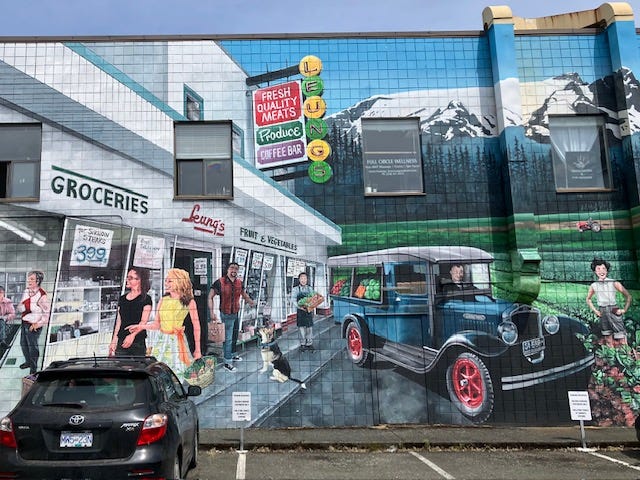
We rode along residential streets to the city of Courtenay, where we parked the motorcycle in the shade and strolled around the downtown area for a bit.
On the road again, taking Island Highway 19A south, we saw a number of shellfish farms close to the coast. The cold and nutrient-rich waters of the area favour this industry. Fanny Bay Oysters, for example, is one of the largest providers on the island, harvesting oysters, clams and mussels.
Continuing south we arrived at Qualicum Beach, in our opinion one of the prettiest stony beaches on the eastern coast of Vancouver Island, with restaurants, walking paths with benches and little hotels bearing witness to its popularity.
I was getting a little tired and Patti needed to stretch her legs, so we took a few more breaks. In Parksville we stopped for a quick meal and then resumed our trip to Nanaimo where the ticket agent told us the 6:20 PM ferry back to Horseshoe Bay was already full. However, we were instructed to position ourselves at the front of a line with a number of other bikes, as space can almost always be found for two-wheelers. This is truly one of the great pleasures of riding a motorcycle in British Columbia.
(Tickets for cars, in case you’re wondering, can be a bit pricey, between $50 Canadian and $80, depending on the route and the type of fare. Passenger fees and taxes are added to that. The ships are well-appointed, with ample seating, onboard restaurants, work areas and children’s play areas.)
Nanaimo to Horseshoe Bay (West Vancouver)
The crossing back to the mainland, as has been our experience in the past, was relaxing and enjoyable. The sun glistened off the water behind the ship as we headed east. At one point a number of passengers made a little commotion as they moved to the port side when whales were spotted a few hundred meters in the distance. The whales were blowing water and seemed to be playing on the surface, exposing their flippers and submerging regularly. A photographer with a large lens told me that this was the seventh trip in a row across the Strait that he had taken pictures of whales. Considering the amount of maritime traffic in these waters, it must be a good indicator of the health of the ecosystem that whales and seals are so prevalent this year.
Back in Horseshoe Bay our group of motorcycles was ushered off the ferry first (another perk). The bigger bikes roared away as we headed our separate ways.
The signs of the zodiac didn’t need to align for this trip. Thanks to our friends and the natural wonders of the region, the circle route had been a grand experience from start to finish.
~~~
~~~
If you’re looking for more information to plan a trip, here are some useful websites:
~~~
Weekly sketch
A quick drawing from a recent visit to Starbucks…
Thanks for taking the time to read all of this week’s post!
Until next time,
-Renato.
PS. My home page with more articles is here. Navigate through topics via the tabs at the top.
Che bel diario di viaggio, Renato!
(Potresti veramente contribuire in modo molto efficace e personale all'ideazione di guide turistiche! ☺️)
Great trip, Renato! And a fantastic time of the year to do it. It's hard to beat the spectacular scenery of the Sunshine Coast and Vancouver Island. Thanks for sharing this fun adventure. I'm with Patty all the way. I'm an Aries and I'm always ready to go further and see more! I'm looking forward to reading about your next adventures. L